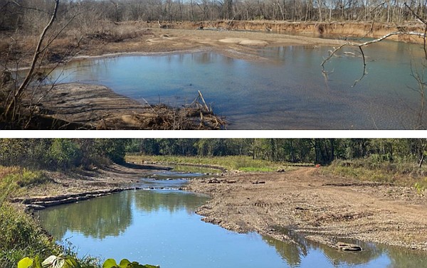
FAYETTEVILLE — An effort to improve water quality in the West Fork of the White River has gained national recognition.
The state Agriculture Department announced work on the West Fork of the White River was featured in the federal Environmental Protection Agency’s July 2002 “Success Story” publication.
To be eligible as an EPA success story, there must be documentation of a waterbody’s improvement or removal from a state’s impaired waterbodies list, according to the Agriculture Department’s news release. A total of 27.2 miles of the West Fork White River has been impaired since 1998 due to high levels of sediment and turbidity. As of 2018, the uppermost 16.5 miles of the river met the state’s water quality criterion for the first time since 1998.
The West Fork White River along with the Middle and East Fork White Rivers are among the major tributaries to the upper portion of Beaver Lake, according to the Agriculture Department. Beaver Lake serves nearly 1 in 6 Arkansans with drinking water.
The success story highlights efforts of the Watershed Conservation Resources Center, Beaver Watershed Alliance, Beaver Water District and the Arkansas Water Resources Center, with funding from the Natural Resources Division.
“This is the result of years of planning and implementation of streambank restoration best management practices to remove sediment and ultimately help protect Beaver Lake, which is the source of our drinking water,” Sandi Formica, executive director with the Watershed Conservation Resources Center, said Friday. “It’s a great example of stakeholders working together.”
Loss of vegetated stream buffers increases streambank instability and erosion. This erosion increases suspended sediment downstream, which poses a significant risk to surface water intakes. Erosion and sediment are the leading source and cause of water quality pollution in Arkansas and across the nation.
The West Fork of the White River originates south of the city of Winslow, according to the EPA “Success Story” report. It joins the Middle Fork of the White River and the White River mainstream just below Lake Sequoyah.
Together, these waters flow for about 13 miles to the upper reaches of Beaver Lake. The upper West Fork of the White River is known for its good water quality and its smallmouth bass and rock bass populations, but the water quality deteriorates quickly as the river nears Fayetteville. The Arkansas Division of Environmental Quality assessed a 33.4-mile section of the river east of Fayetteville and north to the upper reaches of Beaver Lake “as not supportive” of aquatic life. The major cause is high turbidity and excessive silt loads from three primary sources: agriculture land clearing; road construction and maintenance; and gravel removal from streambeds.
One part of the project involved an area near Drake Field in Fayetteville. The work there included stabilizing the streambank, enhancing native vegetation and removing invasive species.
Peter Nierengarten, environmental director for Fayetteville, said the project has benefits beyond water quality.
“It’s definitely important for the water quality improvements to the stream,” Nierengarten said. “It feeds into Beaver Lake so it’s always important to protect the sources of our drinking water. But this project has recreational benefits as well. The West Fork is known for having a population of smallmouth bass and other native fish. And the road that comes down to the stream there is a popular place with folks who like to canoe in the area.”
During an eight-month monitoring period, the project was found to have prevented pollutants from entering the West Fork of the White River system, including 15,000-20,000 tons of sediment, 5,000-10,000 pounds of total phosphorus, and 20,000-25,000 pounds of total nitrogen. The project protected a county road, utility infrastructure and landowners’ properties by preventing as much as 60 feet of lateral streambank erosion and subsequent loss of more than 25 mature trees in an established forested riparian area.